


The 19 communes of the Iroise country
This page provides access to all the heritage elements described for the 19 municipalities of this site.New places to know are regularly put online.
Immediate access to one of the communes : click on its name
|
|
The Community of Communes of the Pays d'Iroise, which is now called Pays d'Iroise Communauté ( PIC ), is one of the oldest in Brittany. It was created in 1992 by the transformation of the Syndicat Intercommunal à Vocations Multiples (SIVOM) of St-Renan, which had already brought together 11 communes since 1989. In 1994, the municipality of Ile-Molène also joined it. Then in 1997, the dissolution of the SIVOM of Ploudalmézeau led to the accession of 8 new municipalities. In 2016 two of them decided to merge. Currently, the Pays d'Iroise Community has 50,440 inhabitants across an area of 317km², or 159 inhabitants perkm². |
|
| Communes | Click on an heritage element | ||
|
Brélès 
Brélès, Brelez in Breton, means plateau where justice is done. One thinks, of course, of the columns of justice near the castle of Kergroadez, but the name of the village is much older and could, according to Fréminville, refer to a feudal mound that has disappeared today, named Castel-Mériadec, near the Aber Ildut river. Plourin's parish part under the Ancien Régime, Brélès became a commune during the Revolution.
Known for its old houses, castles and manor houses as well as the triumphal arch giving access to its church, Brélès has added some modernity under the form of a granite statue, the Brélès Lady, as well as the organization of a great Breton wedding, every year, on August 15th. Today, covering an area of 14square kilometers, it is an agricultural community of 868 inhabitants that is increasingly turning to tourism and promoting its rich heritage. |
The Brélès engraved stele in the Ponant Museum The Bel Air manor The Kergroadez castle (link) Notre Dame Church The Pampas grass |
||
|
Ile-Molène 
Molène has been known since prehistoric times. Excavations carried out close to its coastline have shown that the island was already fully occupied in the Bronze Age, when sea level was only 3m below today's level. by 2000 BC, the island was accessible by boat. Molène probably takes its name from the Breton moul-enez, the island in the shape of a rounded hill ( moul = stack ). A former dependency of the Abbey of St-Mathieu, the village began farming very early on, but its main source of income was the sea, thanks to its small, well-sheltered fishing port and its merchant sailors who sailed the world's seas. When an English liner sank in 1896 in the Fromveur Current, its inhabitants rescued the survivors and earned England's recognition for the care they had given to the many bodies washed up on their coast. Knowing their shortage of fresh water, Queen Victoria offered them a cistern fed by an impluvium.
In 2024, there will be 176 inhabitants on an island measuring 0.75km². |
The « Drummond Castle » Museum in Molène The House of Environment in Molène St-Ronan church in Molène ( link ) The precious water of Molène The sea fennel The great dolphin of the Iroise sea Seaweed from the Iroise Sea The grey seals of the Iroise Sea The goose barnacle and the goose neck barnacles |
||
|
Lampaul-Plouarzel
Lampaul-Plouarzel owes its name to Saint Pol-Aurélien, a Welsh monk who later became bishop of Leon, who would have landed on Armoric shores in the VIe century and founded a monastery later destroyed by the Vikings. Thanks to its naturally sheltered port, Lampaul-Plouarzel has always used gabarres to carry out a cabotage trade. Today, it is a municipality with 2,221 inhabitants, the most densely populated in the Pays d'Iroise, covering an area of only 4km ².
|
Porspaul's orientation table
Seaweed kilns, or coastal soda pits Saint Egarec Chapel Saint Paul-Aurélien church |
||
|
Lampaul-Ploudalmézeau
Lampaul-Plouarzel, a coastal town with a natural port, has seen Mediterranean ships pass through since ancient times. In 1959, a massaliote gold coin from the IVe century BC was found among the seaweeds on its shore. It could have come from the Pythéas expedition. See the document, column opposite. Like Lampaul-Plouarzel above and Lampaul in Ouessant, the town owes its name to the monk Saint Pol-Aurélien who built a monastery in the VIe century on the site of the current church. The territory became a parish in its own right in the Middle Ages, after being a Ploudalmézeau parish part. Mainly farmers, the population of Lampola was 816 in 2024, spread over an area of 6km².
|
The dolmen of the Ribl
The Gallic stele of Croas Men Saint-Pol Aurélien Church The marram gras, fixator of the sands The seaweeds at the lower part of the foreshore The gold currency known as Pytheas' stater Document: Pytheas the Massaliot |
||
|
Landunvez 
Landunvez is a predominantly agricultural municipality with a population of 1,579 in 2024 and an area of 13.5km².
Although its main activity is focused on cattle and pig farming, the commune has an old castle and a magnificent coastline, a real jewel of the Iroise Country, which is well known by hikers and water sports enthusiasts alike. On stormy days, the curious who love thrills flock to the spectacle of a wild coast assaulted by the waves. Every summer, commented walks, a sea festival and concerts are organised for an audience increasingly attached to its charm.
In Landunvez, the associations that defend your heritage are
" SOS Trémazan ". Discover its website : SOS Trémazan as well as the "Association for the Safeguard of the Chapels of Landunvez". website : Association pour la Sauvegarde des Chapelles de Landunvez |
Sentinels of the wild coast
The buried dolmen of Saint Gonvel The great menhir of St-Gonvarc'h The engraved stele of the St-Gonvel chapel The lying stele of the Sainte-Haude fountain The Saint Haude fountain The Potatoes Train Viaduct The Potatoes Train The Argenton sundial The castle of Trémazan Notre-Dame de Kersaint Chapel Saint Samson Chapel Saint-Gonvel Chapel The tourist road of the Wild Coast The Canons' House The peninsula of the Fishpond The former semaphore of Kerhoazoc The old Argenton battery |
||
|
Lanildut 
With a well sheltered estuary port, Lanildut has always been oriented towards the sea. Its name comes from that of Saint Ildut, who, in the Ve century, founded a hermitage near the shore. Many small shipowners, or boat owners, have had their beautiful homes built in the parish. Very active, the port of Lanildut has specialised in the harvesting of seaweed near the Molène archipelago. It has thus become the leading seaweeds port in Europe and supplies several plants producing gelling agents for food or cosmetics. In 2024, the municipality has 1,013 inhabitants spread across its 5.8km².
|
Saint-Ildut Church The Lanildut sundial The obelisk of Lanildut The Lanildut Coastal Battery The Aber-Ildut viewpoint The Seaweed House Seaweeds lower than the foreshore |
||
|
Lanrivoaré 
'Eeum ha kalonek' = Straight and brave
The seat of the Pays d'Iroise Community of Municipalities, Lanrivoaré, formerly a simple hamlet of Plourin, covers 15km² and is an agricultural municipality with 1,551 inhabitants, located near St-Renan. Here a legend places the martyrdom of 7777 saints during the Ve century. Lan Rivoaré ( the monastery of Rivoaré) comes from the name of a hermit whose life could be linked to this legend, probably remembering a later massacre of the population during the Viking incursion of 919.
|
The sundial of Lanrivoaré The Cemetery of the Saints Saint-Hervé Hermitage The engraved stele of the Cemetery of Saints Saint-Rivoaré Church |
||
|
Le Conquet 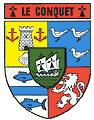
Already in the Middle Ages, man did not say the village but the town of Le Conquet. Occupied since prehistoric times, this port at the end of the world was a shelter on maritime routes and a nest of commercial ships owners. The Normans and then the English devastated him several times. Inland, the village of Lochrist still bears witness to the time when, simply as a part in the parish of Plougonvelin, the historic centre of Le Conquet was located away from the sea. As demographic pressure changed, the Lochrist church was dismantled stone by stone in 1856 to be transferred to its present location.
This is how Anatole Le Braz described Le Conquet in his book Le gardien du feu written in 1899 : Le Conquet, the pearl of Breton ports, a veritable marine hive, buzzing like a conch, with its terraced quays, the four hundred sails of its fishing fleet, its almost seigneurial houses, built in the opulent ages of the buccaneers, its noisy and colourful population, a mixture of all the types and bloods of Brittany. Today, it is still a small, lively town with a population of 2,913 in 2026. Active because of its pretty fishing port, mainly oriented towards crustaceans : edible crabs, lobsters and rock lobsters. But also because of tourism : the old boatsmen's houses, the ria populated by birds, the pier for the islands, the Iroise Marine Natural Park, the long Blancs Sablons beach, the magnificent coastal paths attract a large public. The commune, which owns the Kermorvan peninsula and eight islands of the Molène archipelago, now extends over 8.5 km2. |
The last menhirs of Kermorvan The ria of Le Conquet The birds of the Conquet estuary An exhibition of the Iroise Marine Natural Park The lavoirs of Le Conquet The house of the Golden Lion The house of Lords The lighthouse of Kermorvan The Lochrist light The English House The sundial of the town hall The Poncelin Street Pump The Holy Cross Church Dom Michel Chapel The chapel Saint-Michel or of the Guardian Angel The Bilou sentry box An invasive flora Three Cornered Leek The flora to protect The Jean Hobé promenade The sea cave of Portez The tip of Kermorvan BONUS: A short, previously unpublished tale from Le Conquet |
||
|
Locmaria-Plouzané 
This former Plouzané parish part has been occupied by humans since prehistoric times, as shown by the old Kereven alignment. Many Christianized Gallic stelae show that this occupation has continued. It became a commune during the Revolution, and its former name of Locmaria-Lanvénec was changed, but its 5,130 inhabitants still bear the name Lanvénecois. It was from its shore that the first French transatlantic cable was launched in 1869. Close to Brest and boasting the seaside resort of Trégana, this 23 km2 commune is still essentially agricultural, but is rapidly becoming urbanized and industrialized.
In Locmaria-Plouzané, the association that defends your heritage is
'LOCMARIA-PATRIMOINE'. Discover its website: Locmaria-Patrimoine |
The golden menhirs of Kereven The pretty stele of Goulven Cemetery sentinels The giant stele of Croas Teo The forgotten steles of La Madeleine The steles of the Norman Cross The manor of Kerscao Notre Dame Church The Déolen cove and the first transatlantic cables Ru Vras windmill The fort of Toulbroc'h Seaweeds of the upper part of the foreshore |
||
Milizac was and still is mainly oriented towards agriculture. Its vast territory of 33 km2 is mainly dedicated to cattle and pig breeding as well as potato cultivation. The commune was once the seat of several chatellenies, including the Curru manor house. There are also several water mills and three dovecotes. The new municipality of Milizac-Guipronvel, with a population of 4,816 in 2024, is currently undergoing rapid urbanization thanks to its proximity to Brest. Guipronvel was an agricultural commune that took its name from that of Saint Ronvel whose hermitage, dating back to the VIe century, would have been located in the Coat-Douen woods. First the centre of a large religious district that once encompassed six parishes, Guipronvel became a simple part of the Milizac parish, its neighbour. Then it was autonomous since the Revolution until 2017. In 2016, it decided to merge with its neighbour Milizac.Prior to the merger, it had a population of 787 over its 8.4 km2 area. Its heritage, painstakingly listed by Jean Lescop, a native of Guipronvel, is described in detail and illustrated with numerous photos on the communal website. |
The Gallic stele of Milizac The sundial of Milizac The manor of Keranflec'h The church and parish enclosure of Guipronvel (link) Saint-Pierre and Saint-Paul Church Calvaries and crosses (link) The oratories (link) Castles, manors and noble lands (link) The mills (link) |
||
|
Plouarzel 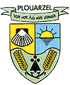
"War vor ha war zouar" = On sea and land
The largest municipality in the Pays d'Iroise, with its 43 km2, boasts the highest menhir in Europe on its territory, thus proving the seniority of its human occupation. The name Plouarzel comes from the name of Saint Arzel, a Welsh monk who came to found the parish in the VIe century. At the end of the Middle Ages, Hervé de Porsmoguer, a brilliant captain from Plouarzel, whose motto became that of the town, distinguished himself in front of Pointe St-Mathieu in a naval battle against the English. He sacrificed his brand new warship and his entire crew in order to sink the enemy flagship.
Knowing a brilliant development thanks to the culture of the wheat and the flax, Plouarzel did not disdain either, from the middle of the XIXth century, the harvest of the seaweed which was burned on the coast to provide bread of soda to the factories of the coast. In 2024, this agricultural community of 4,029 inhabitants is home to the CROSS at the tip of Corsen, which monitors and safeguards the very heavy shipping traffic from the Cotentin Peninsula to the tip of Penmarc'h.
In Plouarzel, the association that defends your heritage is
'TRE-ARZH'. Discover its website: Tre-Arzh |
The giant menhir of Kerloas
Kervéatoux castle The lighthouse of Trézien The headland of Corsen Kerglonou's quarry The Lanhalla dovecote The retting pool of Lanhalla Saint Arzel church and its parish enclosure Notre Dame of Trézien Church The Saint-Eloi Chapel The beautiful stele of the Plouarzel cemetery The steles of the golf road The stele of the old lavoir of Trézien |
||
|
Ploudalmézeau 
It is a bipolar urban area, of 23 km2, with a centre of more than 4000 inhabitants in the countryside and a coastline, Portsall ( = the port of Trémazan castle ), of 2000 residents, four kilometres away. But overall, Ploudalmézeau, the second largest commune in the CCPI with its 6,522 inhabitants, known as Gwitalmeze (meaning "free town") in Breton, was populated very early on, as its megaliths are 6,000 years old. A huge parish originally encompassing four other communes, it transferred its church to its current location in the Middle Ages. It was then dismembered and its mayor guillotined during the Revolution for collusion with the enemy. The town was severely affected in 1978 by the stranding of the tanker Amoco Cadiz in front of Portsall, but fought hard against the gigantic pollution that followed. Its mayor, Alphonse Arzel, then took the lead in a coalition of plaintiff municipalities and finally succeeded to do convicting the polluter 14 years later in the American courts.
|
The tumulus of Carn Island The megaliths of Guilliguy The Gallic stele of the city centre The stele of the Place du Général de Gaulle The hemispherical stele of Sandrioné The beautiful stele of Stang-an-Heol St-Pierre and St-Vincent-Ferrier Church The Moulin Neuf Park |
||
|
Plougonvelin 
This seaside resort covering 18km² now has 4,521 inhabitants. Its location between Pointe St-Mathieu and the Brest Channel has always given it strategic importance and traces of human occupation date back to the Mesolithic period. A Bronze Age necropolis with burials in stone chests has recently been discovered on the Bertheaume plateau, probably indicating the presence of a village 4000 years ago. Later, a Roman road was to join Carhaix ( Vorgium ) to St-Mathieu (Gesocribate ? ). The struggle against England led to several bloody naval battles in the 16th century in front of its coasts and a devastating landing. The parish, which was depending on the powerful abbey of St-Mathieu, saw Lochrist and Le Conquet detach from it during the Revolution. Today, Plougonvelin is focusing on tourism, which is developing around its beautiful beach of Trez Hir and Pointe St-Mathieu.
|
The Gallic steles of St-Mathieu The stèles of the lapidary garden of Keraudy Saint-Mathieu de Fine-Terre Abbey The Pointe St-Mathieu Fire Tower The abbey church of Pointe St-Mathieu The remains of the medieval monastery of Pointe St-Mathieu The missing Maurist building at Pointe St-Mathieu The Chapel of Our Lady of Grace Pointe St-Mathieu Abbey Museum The Memory Museum 39-45 Saint-Gwenaël Church The Toul Logot battery Bertheaume's area The fort of Bertheaume ( link ) The lighthouses of the Iroise Sea The Pointe St-Mathieu lighthouse Memories of a lighthouse keeper. The davits of the coast The Vaéré garden The small carnation of the coast The Pigface or Hottentot fig |
||
|
Ploumoguer
Roman remains testify to the age of human occupation in the territory of this large municipality of 39 km2 which has nevertheless been amputated from its islands and the Kermorvan peninsula for the benefit of the Conquet. Comprising two separate parishes, including that of Lamber, this rural municipality with a population of 2,074 is mainly focused on livestock farming and agricultural production. Its population has been growing by 6.1% since 2013.Its coastline of coves and cliffs, its lookout on the highest hill in the Pays d'Iroise, however, is gradually seeing a growth in hiking tourism.
|
The belvedere of Keramézec
Brenterc'h's low flowered walls The cliff of Brenterc'h The davits of the coast Saint Peter's Church Saint-Pierre-aux-liens Church Locmeven Chapel |
||
|
Plourin 
The two great menhirs of Kergadiou show that man has occupied this territory since the Neolithic period. The parish is said to have been founded in the 6th century by Saint Budoc, whose reliquary of the church has three fingers perilously brought back from Dol by his disciple Saint Ildut. It was one of the most extensive in the Leon, but has been amputated from Larret, Lanildut, Porspoder and Landunvez. Now covering 25km², this agricultural community has a population of 1,268.
In Plourin, the association that defends your heritage is
'Teñzorioù Ploerin'. Discover its website: Teñzorioù Ploerin |
Kergadiou's menhirs
The menhirs of Kerguiabo The fallen stele of Penn an Dour The Columns of Justice The sundial of the town hall The manor of Kerenneur Saint Roch Chapel St-Budoc Church, currently closed to the public ( link ) |
||
|
Porspoder
As shown in the list opposite, Porspoder is the capital of the megaliths of the Iroise country. But not only that: this former Plourin parish part, which became a parish in the 17th century, has a superb coastline that always attracks walkers. The lap around the St. Lawrence Peninsula is one of the most beautiful discoveries in the region. The municipality thus combines the advantages of the countryside and the sea. And if it has lost the port of Aber to Lanildut, it has managed to maintain the originality of the port of Mazou and benefited from the attachment of the former commune of Larret, two charming places that delight tourists. The municipality has 1,753 inhabitants and covers an area of 11km².
In Porspoder, the associations which defend your heritage are : Agit'Glaz and Cap à l'Ouest en Pays d'Iroise |
The great menhir of Kerhouézel
The menhirs of the St-Laurent peninsula Traonigou's menhirs The megaliths of Kerivoret and Prat Joulou The megaliths of Melon Island The dolmen of Poulliot Mesdoun's menhirs The menhirs and the engraved slab of St-Denec The lower ovoid stele of the Dreff The low ovoid stele of Prat-Paul The Gard'Sign ( or Garchine) orientation table Mazou, the small mooring stakes port Saint-Ourzal Chapel Saint-Budoc Church The sentry box of Melon Dune panicum Seaweed from the Iroise Sea |
||
|
Saint-Renan 
The main city of the entire CCPI territory, St-Renan was from the Gallo-Roman era a place where cassiterite, the tin ore, deposits were mined. In the Ve century the Irish hermit Ronan founded his first hermitage there. An important medieval center with a court of justice, the town, with 8,577 inhabitants and an area of 13km², has become a very active historical, commercial, and cultural center. Once mainly oriented towards livestock, its weekly Saturday morning market still attracts a considerable public at the foot of medieval houses. Thanks to its central position in the Iroise Country, its proximity to Brest, its vast bodies of water, the city, in full expansion, is experiencing a dynamism that many others envy it.
In St-Renan, the association that defends your heritage is
'LE MUSEE DU PONANT'. Discover its website: Musée du Ponant |
The Ponant Museum The Brélès engraved stele in the Ponant Museum The Cardinal House The Gérard House Notre-Dame de Liesse Church The Thieves chapel The Great Lavoir The primrose willow (link) The search for tin in St-Renan The birds of the lakes of St-Renan |
||
|
Trébabu
The name of this small neighbouring commune of Le Conquet comes from that of Saint Tugdual, also known as Saint Pabu. This Welsh monk who came to evangelize the Armorican country would have established his first monastery there as early as the Ve century. Focused on livestock farming and agricultural production, Trébabu, which covers only 4km², is developing its housing estates in order to significantly increase its population, which currently stands at just 368 inhabitants. Its church, nestled in the hollow of a romantic valley, and its Notre-Dame du Val chapel, whose main statue has recently undergone an astonishing peregrination, are worth a visit.
|
The drudgery boundary stone
Notre-Dame du Val Chapel St. Tugdual Church |
||
|
Tréouergat
This small commune of 6 km2, located at a good distance from the coast, is naturally rural. It has been occupied at least since Gallic times, as shown by the stelae that still remain. Ancient parish part of Plouguin, its name comes from that of Saint Gouescat, also named Saint Ergat, patron saint of the parish, to whom is dedicated, in the woods, a sacred fountain. Several small manors and remarkable houses testify to its past importance. During the Second World War, it hid an important maquis. Every year in May, its 323 residents organize a large horse festival that attracts horse enthusiasts from across the department to Tréouergat.
|
The Kergoff maquis The stele of Penn-ar-Prat Saint-Gouescat church The steles of Saint-Ergat The Saint-Ergat fountain The missing sundial The japanese knotweed |
READ MORE :
Ed.FLOHIC 1998. Coffret de 2 tomes
Coll."Le Patrimoine des communes de France".
A remarkable work due to the voluntary collaboration between several hundred local historians.