


Access :
It is easy to get there and even to go around it. The lighthouse of Kermorvan is located at the end of the peninsula of the same name in Conquet. You can get there from the D28 at the exit of Le Conquet in the direction of the Blancs Sablons beach.
Parking in the isthmus at the end of the road. Then follow on foot the small tarred road behind the barrier. The lighthouse is 1 km away. There are 77 steps to climb.
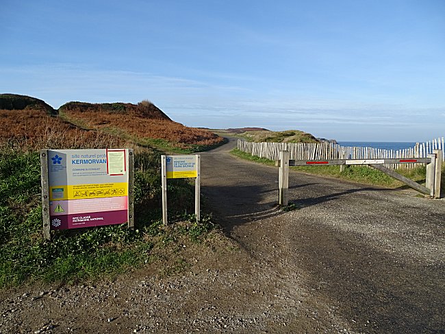
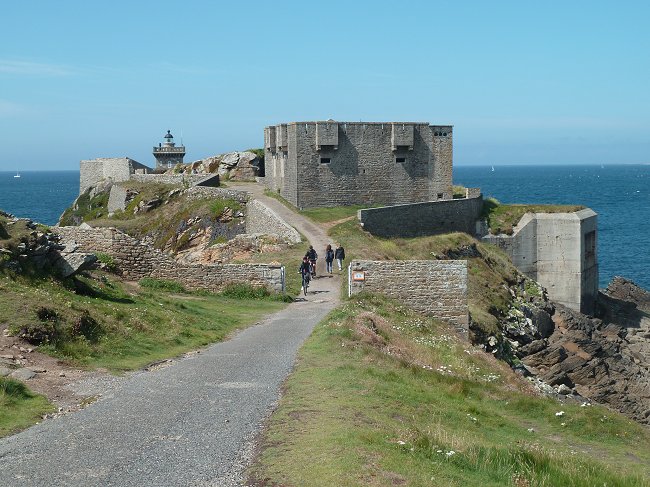
Let's enter the enclosure of a 19th century fort. At the foot of the fort, take the right-hand path that leads to the north face. Then continue straight on, keeping the sea on the right. A paved path suddenly gives us a magnificent view of the lighthouse.
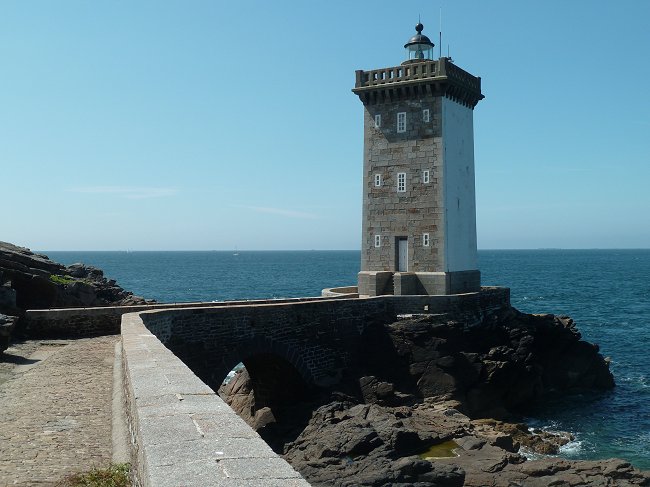
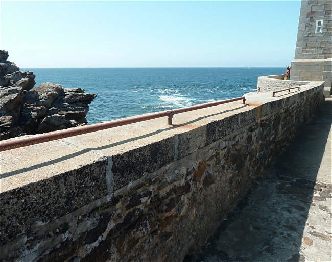
A bridge was built to access it. At this point, a series of rings on one side of the parapet and two old metal bars on the other will be noticed.
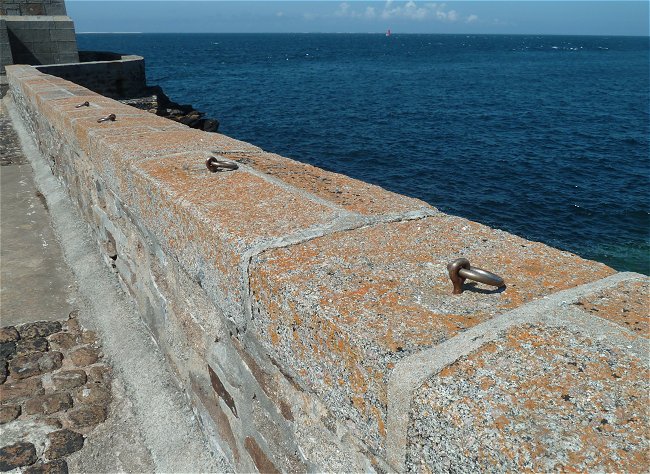
You have to imagine the seas crashing against this bridge on stormy days. In order to allow access to the lighthouse in relative safety in the past, it was possible to hang on to the bars or to a rope attached to the rings. It is not necessary today, there is no longer a keeper, the lighthouse is remote controlled from Ushant.
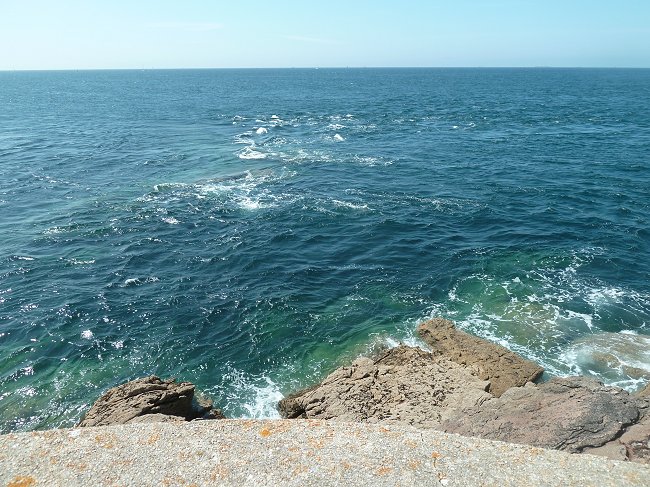
At the foot of the lighthouse, the walkway allows the visitor to become aware of the dangers of sailing close to this point. The pitfalls are apparent and the violence of the current is obvious.
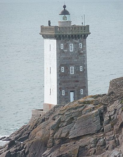
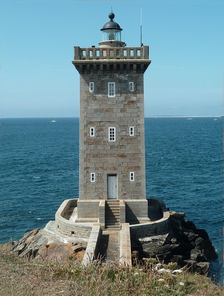
Ideally located at the extreme headland of the peninsula, Kermorvan is the most western land lighthouse in France.
© From a map in the DIRM NAMO - Phares et Balises archives
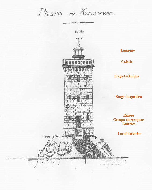
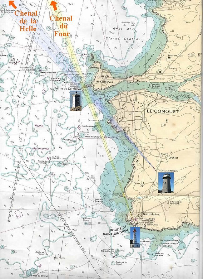
Commissioned in 1849 under the direction of engineer Louis Plantier and with a total height of 20.35 m, it gives the direction of the Four channel when aligned with the St-Mathieu lighthouse and that of the Helle channel if aligned with the Lochrist light.
In reality, the beams colored here in yellow and blue are white.
From the marine chart 7122P published by SHOM
" De la pointe St-Mathieu au phare du Four "
The Four Channel, which opens up to the north of the peninsula, is the navigable part of the Iroise Sea located between the coast and the Molène archipelago. It extends to the English Channel and presents many dangers : a powerful current that reverses with the tide, hundreds of reefs often responsible of wrecks, not to mention a sometimes very violent wind that the sailing ships has always feared in particular. Since ancient times, ships have always followed the Four Channel to the English Channel and the North Sea. Compared to the seaway off the archipelago, this route saved them valuable time.
The Molène archipelago is not parallel to the coast, so another channel, the La Helle, leads there.
On the floor above the entrance, the guard had a room with a four-poster bed and a small kitchen on the side. It was his private place where he could invite his family.
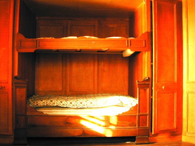
The four-poster bed has since been given a bunk bed for the purposes of a film
© Photo J-Y Le Bars
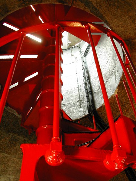
The lantern is reached by a bright red metal staircase.
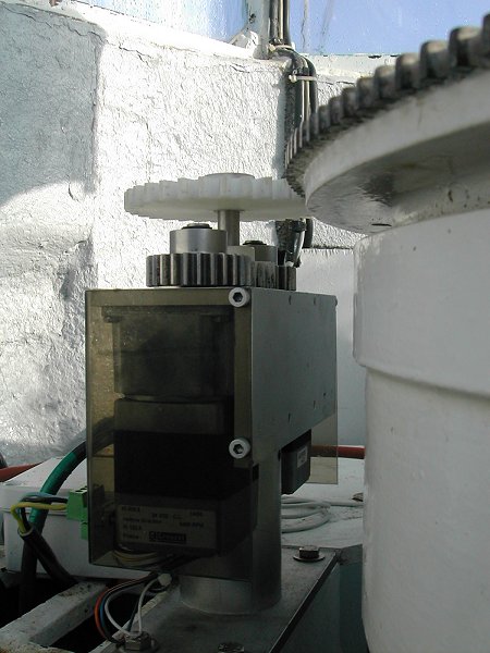
The rotation system of the light device located above is opened. This is also where the weight of the driving force for this rotation came from before electrification. We can still see the mercury tank on which the entire lighting system rotates.
Inside the lantern.
Photos J-Y Le Bars
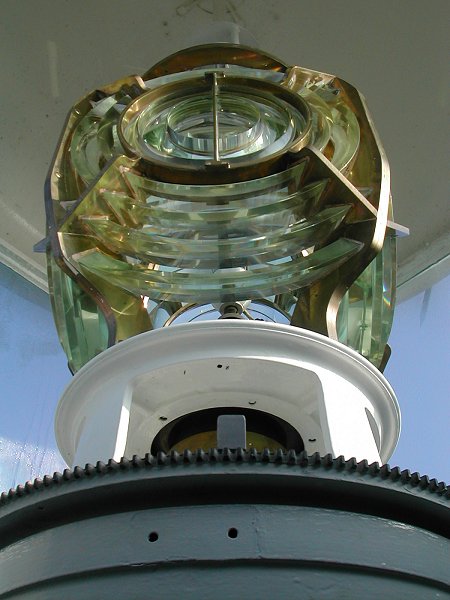
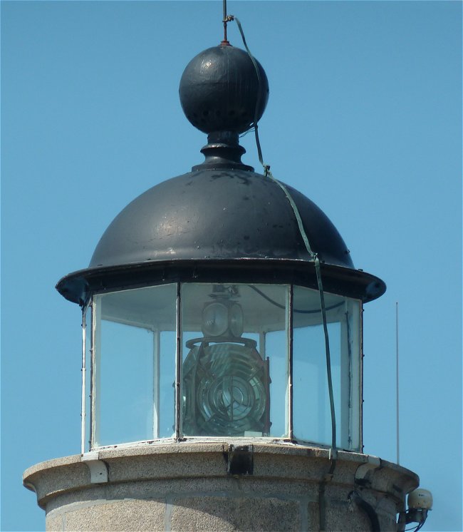
This set consists of a 180 watt led lamp placed in the center of Fresnel lenses with steps. It produces a regular white glow every 30 seconds. Its range is 22 miles, or 40.74 km.
A foghorn was installed in 1874. It is now a horn that is automatically triggered day and night when visibility becomes insufficient.
During the Second World War, the lighthouse, whose lighting system had been dismantled, was not damaged despite the construction of a series of bunkers nearby. It was automated in 1994 and is now remotely controlled from Ushant.
Schedules, rates, reservations :
Cliquez ICI
Leaving the lighthouse enclosure, you can't miss the coastal path of this superb peninsula. Another page of this site describes it in detail.
The superb headland of Kermorvan
Thanks to Jean-Yves Le Bars, former lighthouse keeper, for his advice and his loan of documents which allowed the writing of this page.